iFly EFB
- 4.9
- Rating
- 50.00K
- Installs
- Free
- Price

 Analysis by App-foxy
Flying with an electronic flight bag is not simply a matter of replacing paper charts with a brighter screen. The useful question is whether the app stays understandable when attention is divided between planning, weather, aircraft setup, and the cockpit itself. After spending time with iFly EFB, I found its strongest appeal in that practical space: it is an aviation navigation app from Adventure Pilot, LLC, designed for both VFR and IFR work, while still being approachable enough for pilots who do not want a cluttered tablet experience.
It is listed as a free app for Everyone, with optional in-app purchases ranging from $0.99 to $179.99 per item. That combination is worth understanding before installation. The initial download does not necessarily represent the complete cost of using every aviation resource you may want, so I would treat the free entry point as a chance to evaluate the workflow rather than assume the entire EFB experience is included at no cost.
How connectivity changes the experience
I find connectivity matters most while I’m preparing, not once I’m airborne. This section looks at how I’d use a reliable connection to get ready, then keep the cockpit workflow focused if that connection changes. That distinction also helps set realistic expectations for what a mobile EFB can—and cannot—take off a pilot’s hands.
You May Also Like

 Blood Strike: 2.5 Anniversary
Blood Strike’s Loadouts Turn Every Drop Into a Tactical Gamble
A close look at Blood Strike’s custom loadouts: how fast access to signature weapons reshapes its battle royale rhythm, rewards preparation, and narrows the gap between fights.

 Pandora - Music & Podcasts
Pandora’s Music Is Easy to Start, but Harder to Recover
Pandora’s strength is its low-effort path from a seed to a station. Its weak spot is how much confidence it asks you to place in connection, setup, and quiet recovery.

 8 Ball Pool
 Is Built on Rivalries, Rematches, and Routine
A close look at the rivalries, rematches, shared routines, and unanswered safety questions that turn a quick pool match into a persistent mobile community.

 Samsung Music
’s Quiet Strength Is Playing What You Already Own
Its reach comes less from spectacle than from dependable access to a personal library. That simplicity is both the app’s strongest retention engine and its ceiling.

 AccuWeather: Weather Radar
AccuWeather Review: A Quick, Clear Forecast for Everyday Decisions
For everyday plans, the best forecast is the one you can understand quickly. AccuWeather makes rain timing, radar, and local conditions easy to act on, with a few trade-offs.

 Hill Climb Racing
Why Hill Climb Racing Still Turns Crashes Into One More Run
A tiny car, a bumpy hill and one more upgrade: Hill Climb Racing keeps resurfacing because its simple chaos makes every near-miss feel personal.
More From Our News Desk



Planning is easiest when the connection is stable
The first thing I noticed is that connectivity matters most before the aircraft moves. When I am at home or at the airport with a reliable connection, the app feels much more comfortable as a planning tool. I can take time to inspect the route, think through the flight, and make sure the information I need is ready before cockpit workload increases. That preparation is more important than any individual button because a navigation app is only useful in flight if the pilot has already organized the relevant material.
That also changes how I judge an EFB. A phone or tablet may have a strong cellular connection on the ground and a very different situation once airborne. I would not build a flight plan around the assumption that a network will always be available. Instead, I see the connected phase as the time to prepare thoroughly, verify what I intend to use, and avoid discovering at the departure point that a desired resource still needs attention.
For VFR flying, this can be especially helpful during a casual local trip that becomes more complicated because of changing weather or a new destination. For IFR work, the same principle is more demanding: the route and supporting information need deliberate preparation, not a last-minute search while managing the aircraft. The app can support that process, but it does not remove the pilot’s responsibility to understand the flight or to use appropriate current aviation information.
Mobile use reveals both the strength and the friction
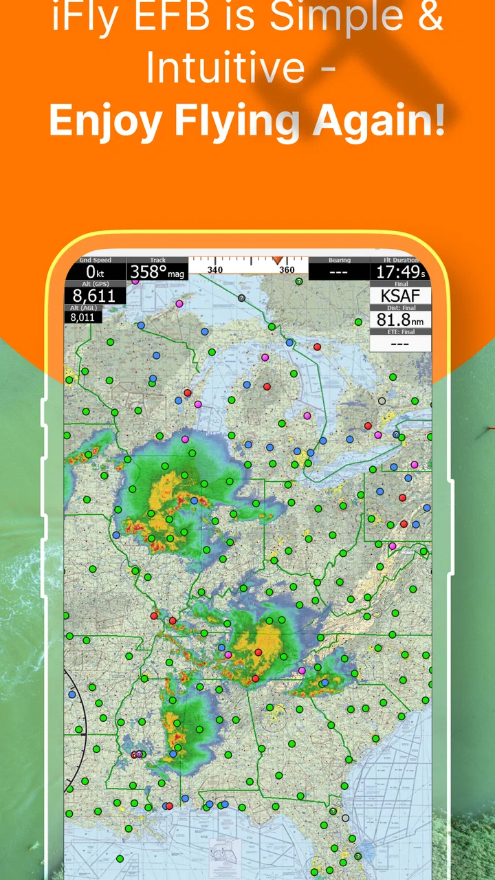
iFly EFB makes the most sense on a larger mobile screen, where a chart or route can be viewed without constantly zooming and panning. On a phone, I would reserve it for quick checks, short planning tasks, or situations where portability matters more than visual comfort. A phone is easy to carry, but aviation information can become tiring to inspect when the display is small and the surrounding environment is bright or distracting.
In a real everyday scenario, imagine preparing an early morning flight from a kitchen table, then moving to the airport and finally into the cockpit. I would use the connected home or airport stage to organize the flight, then keep the device positioned so that the information can be consulted with minimal interaction. That workflow reduces the temptation to depend on a live connection at exactly the time when attention should remain outside the screen.
The app’s value is therefore tied to how well it fits your device and habits. A pilot who already carries a suitable tablet and is comfortable with electronic charts will probably find the transition natural. Someone expecting a phone-sized app to replace every planning resource may find the experience cramped. This is not a criticism unique to the software; it is a reminder that navigation information needs usable screen space, readable labeling, and a mounting position that does not interfere with flying.
What happens when the network becomes unreliable?
Connectivity uncertainty is the area where I would be most cautious. I do not treat a connected aviation app as a guarantee that every resource will remain available in every part of a flight. Before departure, I would confirm that the material I expect to consult is already ready on the device and that I understand how I will proceed if the connection disappears. That is a sensible habit with any EFB, and it is particularly important when the app offers a broad set of VFR and IFR uses.
There is a practical difference between an app being installed and an app being prepared for a specific flight. Installation gives you the software. Preparation means checking the route, reviewing the relevant information, charging the device, and having a backup plan. I would not confuse those steps. A pilot who opens the app only after leaving reliable coverage is taking an unnecessary risk, regardless of how polished the interface feels on the ground.
If information is slow to appear, my first response would be to simplify rather than repeatedly tap. I would return to the last known useful view, avoid making a network-dependent task the center of the flight, and use the aircraft’s approved primary resources and backup procedures. That approach is less exciting than treating the tablet as an all-purpose answer, but it is much more realistic. The app should support sound cockpit decisions, not encourage improvisation around a missing connection.
Recovery depends on preparation more than cleverness
A good recovery routine begins before anything fails. I would make a habit of opening the app before engine start, checking the intended route, and giving myself enough time to notice whether the device is behaving normally. I would also keep the tablet’s battery and physical placement in mind. A navigation tool that is technically available but difficult to read, poorly positioned, or nearly out of power is not a dependable tool.
When a connection drops, the best response is usually to avoid unnecessary changes. If the current view remains useful, I would keep working from it rather than repeatedly refreshing. If a route needs major revision, I would use the most reliable approved alternative available to me and treat the app as one part of the cockpit setup. This is where experienced pilots will appreciate the distinction between convenience and redundancy: iFly EFB can be helpful, but it should not be the only plan for handling an unexpected problem.
That limitation is also relevant to new pilots. The app may make charts and route preparation feel more approachable, but easier access does not equal easier decision-making. A beginner still needs to learn what the information means, how to cross-check it, and when to stop interacting with the screen. I would recommend learning the application during low-pressure planning sessions, not making the first serious test during a demanding flight.
Using data without letting it dominate the workflow
Because the app sits in the Maps & Navigation category, it is natural to focus on charts, routes, and location information. Yet the best experience comes from using only what helps the current decision. A screen full of useful aviation material can still become distracting if I keep opening layers or moving between views without a clear reason. My approach is to decide what I need before touching the device: route awareness, a location check, a planning reference, or a specific VFR or IFR task.
This is one of the less obvious trade-offs of an EFB. More information can improve preparation, but it can also create a false sense that every detail must be monitored continuously. I prefer to use the app as a structured reference rather than as a source of constant stimulation. That means setting up the route carefully, keeping the display readable, and resisting the urge to explore unrelated material once the aircraft is moving.
Data-conscious use also means being realistic about optional purchases. Since the app is free to install but includes individual purchases between $0.99 and $179.99, I would identify the resources that match my flying before spending anything. A recreational VFR pilot may need a different package or workflow from a pilot who regularly plans IFR flights. The sensible path is to start with the tasks you actually perform, then expand only when the added material solves a real problem.
Who will get the most from this EFB?
I think iFly EFB is best suited to pilots who want one aviation-focused workspace for route preparation and in-flight reference across VFR and IFR contexts. It is also a good fit for someone who values a purpose-built tool more than a collection of general map apps. The high user response—an average rating of 4.9 from around 700 ratings, with over 300 written reviews—suggests that many people find the overall experience convincing, although personal fit still depends on device, flying style, and expectations.
The app has also reached over 50,000 installs, which gives it a meaningful presence without making it feel like an anonymous utility. Its release history goes back to January 20, 2014, so it is not a new experiment appearing without context. For me, that matters less as a badge of age than as a sign that the product belongs to an established aviation-app category rather than being a short-lived novelty.
I would be more hesitant to recommend it to someone who wants a completely free, general-purpose map for occasional road travel, hiking, or simple location sharing. That is not what this app is for. I would also caution pilots who dislike subscription-like planning decisions or optional content purchases. Even though the app itself is free, a serious aviation workflow may lead you to consider paid additions, and that should be part of the decision from the beginning.
How it compares with ordinary navigation alternatives
Compared with a standard phone mapping app, iFly EFB is much closer to the way a pilot thinks about a flight. A road-navigation application is excellent at turn-by-turn driving and everyday destinations, but it is not designed around the visual language or planning needs of VFR and IFR operations. Using one as a substitute would leave too much aviation context to the pilot’s imagination.
Compared with paper charts, the app offers a more flexible way to carry and consult information, especially when planning changes. Paper remains easy to understand at a glance and does not depend on a battery, screen brightness, or device behavior. The electronic advantage is convenience and organization; the paper advantage is simplicity and independence from electronics. I would not frame the choice as old versus new. A careful pilot can value the app while still respecting the usefulness of a backup.
Compared with a generic tablet note-taking setup, the aviation focus is the main reason to choose this product. Notes and screenshots can support a flight, but they do not create the same coherent navigation workflow. On the other hand, pilots who already have a preferred EFB ecosystem may not gain enough by switching. The better option is the one that matches your existing preparation habits, keeps information current in the way you expect, and does not force you to relearn critical actions under pressure.
Small habits that make the app more useful
I would begin by separating “planning time” from “cockpit time.” At home, I would explore the route and decide what information is relevant. At the airport, I would perform a final practical check of the device and intended views. In flight, I would use the app for short, purposeful consultations rather than continuous browsing. This simple division makes connectivity less stressful because the network is treated as a planning aid, not as a promise.
My second tip is to test the workflow on an uncomplicated flight before relying on it for a more demanding trip. That reveals whether the screen is comfortable, whether the device is easy to position, and whether the app’s organization suits your thinking. It also gives you a chance to notice friction without the pressure of weather, unfamiliar airspace, or a tight schedule.
Finally, I would keep the purchase decision tied to a specific need. Do not buy every available item simply because it appears useful. First ask what kind of flying you actually do, how often you need the information, and whether it improves preparation enough to justify the cost. This is a more disciplined way to use a free app with optional purchases, and it prevents the EFB from becoming an expensive collection of material that you rarely consult.
My connectivity verdict
My overall impression is positive, with one important qualification: iFly EFB works best when I treat connectivity as part of preparation rather than as a permanent cockpit resource. Its aviation focus, support for both VFR and IFR planning, and approachable entry point make it more relevant to pilots than an ordinary map application. The app is free to start, carries an Everyone age rating, and comes from Adventure Pilot, LLC, but the optional purchase structure means serious users should think about their actual requirements before expanding their setup.
The strongest habit is simple: prepare while connected, fly without assuming the connection will save you. That mindset lets the app do what it does well—organize aviation information and support navigation decisions—without asking it to replace judgment, backups, or established cockpit discipline.
I would recommend giving it a careful trial if you fly VFR or IFR and want a dedicated mobile EFB rather than a general map. I would skip it if your needs are limited to everyday directions or if you are unwilling to plan around device and network limitations. For the right pilot, it can become a practical companion; for everyone else, the free installation is still best viewed as an evaluation step, not an automatic replacement for every navigation tool already in the flight bag.
FAQs for iFly EFB
01What is iFly EFB, and who is it designed for?
iFly EFB is an electronic flight bag application designed primarily for pilots who need digital aviation charts, navigation information, flight planning tools, airport data, and in-flight reference material. It is especially associated with general aviation and pilots flying compatible aircraft or using supported navigation equipment. Before downloading, users should confirm that the app’s features, chart coverage, and supported devices match their region, aircraft, and operational needs.
02What features does iFly EFB provide for flight planning and navigation?
The application typically combines moving-map navigation with aviation charts, airport and airspace information, route planning, weather-related resources, and other pilot-focused tools. Depending on the subscription, region, device, and connected equipment, it may also support GPS positioning, traffic or weather data, flight logging, and integration with compatible systems. Pilots should review the current feature list because availability can vary between platforms and service plans.
03Does iFly EFB work without an internet connection during a flight?
iFly EFB can generally be used offline for important functions when the required charts, databases, and other resources have been downloaded in advance. However, live weather, traffic, online updates, account synchronization, and certain connected services may require an internet connection or compatible external hardware. Pilots should update all data before departure and verify that offline maps and required information are accessible rather than relying on an untested connection.
04Is iFly EFB free to download, or does it require a subscription?
The app may be available as a free download, but access to complete chart coverage, navigation databases, advanced planning features, updates, or connected services can depend on a paid subscription or a specific iFly product package. Pricing and included features may differ by country, operating system, and subscription level. Users should check the official store listing and current terms before downloading or purchasing an annual plan.
05Can iFly EFB replace official paper charts or certified aircraft instruments?
iFly EFB is a useful planning and situational-awareness tool, but it should not automatically be treated as a replacement for certified aircraft instruments, approved navigation equipment, or legally required aeronautical publications. Its suitability depends on local aviation regulations, aircraft equipment, operating rules, and the pilot’s procedures. Always carry an appropriate backup, keep data current, and confirm the app is authorized for the type of operation being conducted.
Pros
- Detailed aviation charts
- plates
- and airport information in one app.
- Offline access helps pilots prepare and fly without constant connectivity.
- Route planning tools support quick flight preparation and briefing.
- Regular data updates help keep navigation information current.
- Designed specifically for pilots
- with a focused and practical interface.
Cons
- Many advanced features require a paid subscription or separate purchase.
- The amount of aviation data can feel overwhelming for new pilots.
- Initial downloads may require substantial storage space and time.
- Some functions depend on compatible regional chart coverage.
- A reliable device and backup navigation method are still essential in flight.

iFly EFB
Gallery